
 en
en italiano
 čeština
 Deutsch
 français
 hrvatski
 magyar
 polski
 српски
 русский
 中文
中文 中文
中文 한국어
한국어 español
Slope Vectors

Ribbon: Add-On > DTM > Slope Vectors
Toolbar: PCAD > Add-On > Slope Vectors
Menu: Add-On > Slope Vectors
Keyboard: SLOPEVECTORS
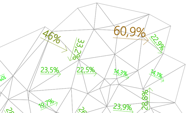
This command creates the slope vector grid of a terrain represented by 3D Faces. It allows you to select how dense the grid of slope vectors will be when superimposed on a 3D terrain represented by 3D Faces. The grid text will have different sizes and colors based on the slope value, providing a visual representation of the terrain’s steepness.
PROCEDURE
Run the SLOPEVECTORS command
Optional: Choose one of the following options:
- C (Color): Opens a dialog to select the vector color.
- S (Step): Enter a percentage (1–10) to define the grid step.
- You can skip both options if you prefer
- Select the 3D face terrain to apply the command and press Enter.
In the image below, a segment of 3D terrain is shown with slope vectors. These vectors indicate the direction and steepness of the slopes, highlighting areas of low, moderate, and high inclination.
How do I...